
Thuringia
Thuringia is one of the 16 federal states of Germany. It is a landlocked state in the centre of the country and covers 16,171 km2 (6,243.7 square miles). It is bordered by Lower Saxony to the northwest, Saxony-Anhalt to the northeast, Saxony to the east, Bavaria to the south, and Hesse to the west. The state has a population of around 2.2 million people, and has been known colloquially as the Green Heart of Germany because of its extensive, broad and dense forests. The largest city and state capital is Erfurt. Most of Thuringia is in the Saale Drainage Basin, a left bank tributary of the Elbe.
The landscapes of the state are quite diverse. In the far north are the Harz Mountains, after which the Goldene Aue, a fertile floodplain around Nordhausen, has the Helme as its most important river. The northwest includes the Eichsfeld, a hilly and sometimes forested region from which the Leine River emanates.
The central northern parts of the state are defined by the 3,000 km wide Thuringian Basin, a very fertile and flat area around the Unstrut River and completely surrounded by hill chains. South of the basin is the state’s largest mountain range marked by the Thuringian Forest in the northwest, the Thuringian Highland in the middle and the Franconian Forest in the southeast.
Werra River – ©Benutzer:Hejkal CC BY-SA 2.0 DE via Wikimedia Commons
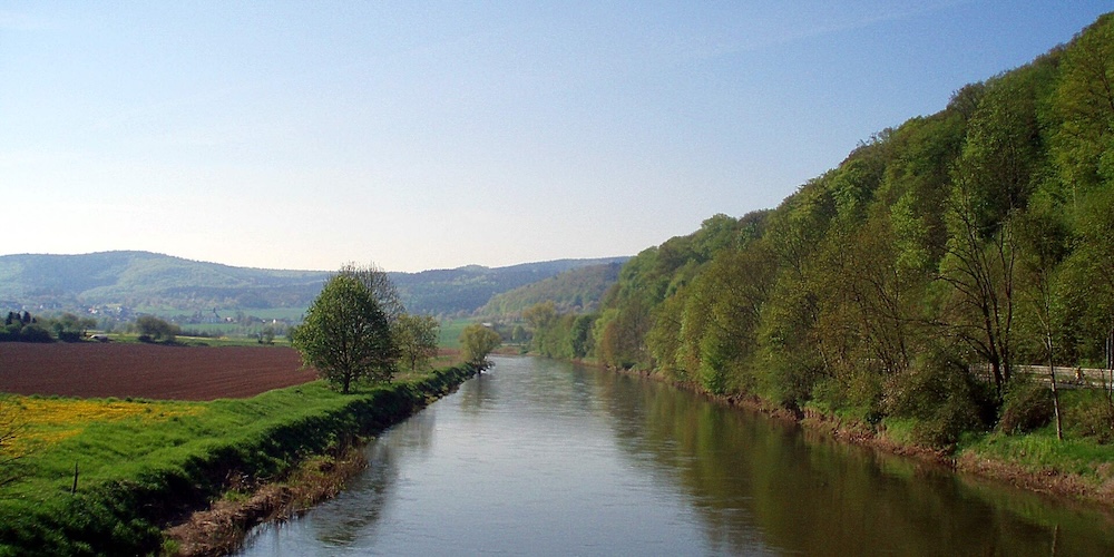
Most of the range is forested. To the southwest the forest is followed up by the Werra River Valley, dividing it from the Rhön Mountains in the west and the Grabfeld Plain in the south. The Saale in the west and the White Elster in the east are the two big rivers running from south to north and forming densely settled valleys in the area.
In between them lies the flat and forested Holzland in the north and the flat and fertile Orlasenke in the middle, and the Vogtland, a hilly non-forested region in the south. In the far eastern region is the Osterland along the Pleiße River, a flat, fertile and densely settled agricultural area. While there are no large natural lakes in the state, it does have some of the largest artificial reservoirs, including the Bleiloch Dam and the Hohenwarte Dam on the River Saal.
The state’s climate is temperate, with humid westerly winds predominating. As one moves from the northwest to the southeast, the climate shows continental features. Winters can be long and cold, and summers can become very warm. Dry periods are often recorded, especially within the Thuringia Basin, leeward to mountains in all directions. It is Germany’s driest area, with an annual precipitation of less than 500mm.
Birding Thuringia
Some of the original Thuringia beech forest can still be found in the Hainich Mountains today. In the uplands, a mixture of beech and spruce would be natural. However, most of the plains have been cleared and are in intensive agricultural use, while most of the forests are planted with spruce and pine.
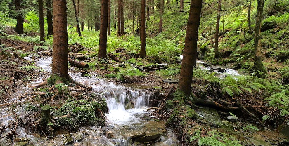
Thuringian Forest Nature Park – ©Pumapuna CC BY-SA 4.0 via Wikimedia Commons
For the last 35 years, the forests have been managed to aim for more natural and resilient vegetation, but agriculture is still predominantly conventional. Some environmental issues remain, such as the salination of the Werra River, caused by discharges from salt mines and from overuse of agricultural fertilisers. However, there has been over three decades of effort to protect natural reserves. This includes the creation of the state’s first national park in the Hainwich Mountains, and others such as the Rhön Biosphere Reserve, the Thuringian Forest Nature Park and the South Harz Nature Park.
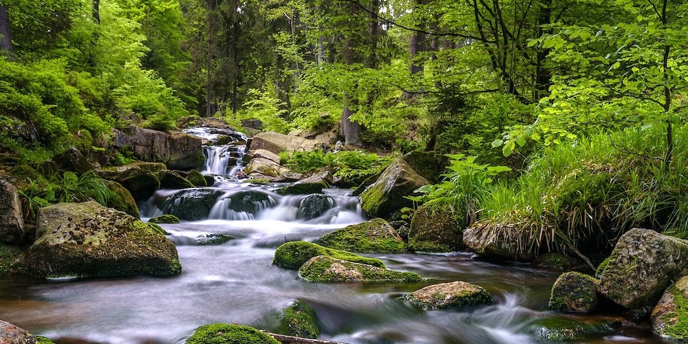
Harz Nature Park – ©Christian Graef CC BY-SA 4.0 via Wikimedia Commons
More than 320 bird species have been recorded in Thuringia, unsurprising given its diverse habitats of river valleys, dense ancient forests and expansive wetlands.
The Hainich National National Park, consisting of large stretches of primeval beech forest, holds some interesting species such as Middle-spotted Woodpecker and Black Stork, as well as the usual woodland species. The Thuringian Forest Nature Park also holds both these species and Black Grouse and a range of woodland species including other woodpeckers and woodland owls and its fast-flowing streams are good for Dipper. The Unstrut River in the Thuringian Basin has a vital wetland from migrating waterfowl. Rückhaltebecken Straußfurt made famous by the hundreds of common cranes that roost there in the autumn. From May to October lake levels are low with many birds taking advantage of the wetland which floods more extensively when the reservoir discharges from Autumn through to the following spring. The site is also good for both Black-necked Grebe and Black Tern.
The range of habitats in the state mean that birding can be productive, whatever the season.
-
Wikipedia
GNU Free Documentation License
https://en.wikipedia.org/wiki/Thuringia
-
Number of bird species: 329
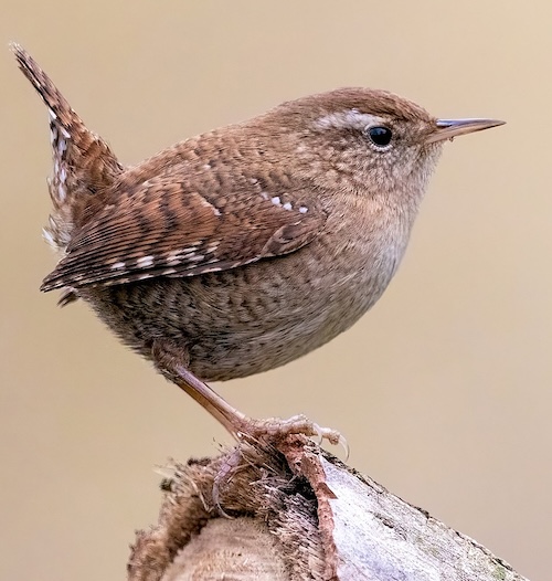
(As at June 2026)State Bird - Wren Troglodytes troglodytes
-
Avibase
PDF ChecklistThis checklist includes all bird species found in Thuringia , based on the best information available at this time. It is based on a wide variety of sources that I collated over many years. I am pleased to offer these checklists as a service to birdwatchers. If you find any error, please do not hesitate to report them. -
eBird
PDF ChecklistThis checklist is generated with data from eBird (ebird.org), a global database of bird sightings from birders like you. If you enjoy this checklist, please consider contributing your sightings to eBird. It is 100% free to take part, and your observations will help support birders, researchers, and conservationists worldwide.
-
Federation of German Avifaunists (Dachverband Deutscher Avifaunisten e.V. - DDA)
WebsiteThe Dachverband Deutscher Avifaunisten e.V. (DDA) is an umbrella organisation for all German avifaunists. The website contains a wealth of information about the DDA and its monitoring programmes. Here you will find advice and information on bird registration and recording projects, some initial results and completed publications, details of competent local contacts or up to date avifaunistic information and schedules. -
Thuringia – Thuringia Ornithological Society
WebsiteGesellschaft für Vogelkunde und Vogelschutz. Thuringia Ornithological Society (Province in East Germany)The society furthers the study and protection of birds on a scientific basis and maintains and promotes contact to other nature protection organisations in the tradition of ornithological work in Thuringia.
-
BR Rhön
InformationSatellite ViewThe Rhön Biosphere Reserve includes the entire central area of the Rhön Mountains, a low mountain range in the German states of Hesse, Bavaria and Thuringia. -
NP Hainich
InformationSatellite ViewIt is the 13th national park in Germany and the only one in Thuringia. The Hainich Forest features a wide range of beech forest communities, with populations of ash trees, hornbeams, maples, lindens, and occasional checker trees. Many fungi can be found there, along with stands of flowers such as summer snowflakes and anemones. Animals in the park include wildcats, 15 species of bats, 7 species of woodpeckers, and over 500 types of wood beetles. -
NPa Harz – Brunswick Land – Eastphalia
InformationSatellite ViewIn central Germany extends from the Flechtingen Hills in the north to the gypsum karst region on the southern edge of the Harz and from east to west over the entire width of the mountain range on the territory of the three federal states of Lower Saxony, Thuringia and Saxony-Anhalt. -
NPa South Harz
InformationSatellite ViewThe act designating this nature park is the fifth nature park in Thuringia. It has an area of 267 km². Within the nature park there are ponors, karst springs, subsidence lakes and dolines as well as steep gypsum cliffs. Thanks to the many caves, numerous species of bat - including the barbastelle - live in the beech woods, where they find suitable places to roost. It is also home to the wildcat and lynx. Areas of dry grassland with orchids are the remnants of old meadows and pastures on the karst surfaces. -
NPa Thuringian Forest
InformationSatellite ViewIt extends around the Rennsteig and comprises almost the entire Thuringian Forest and the Thuringian Highlands with Eisenach in northwest and Sonneberg in the south. It includes further the 170 km2 (66 sq mi) biosphere reservation Vessertal-Thüringen Forest, and a number of dams like Tambach-Dietharz Dam, Schmalwasser Dam, Ohra Dam, Lütsche Dam and the Leibis-Lichte Dam. -
NR Alter Stolberg
InformationSatellite ViewThe Alter Stolberg is a wooded karst plateau, up to 357.7 m above sea level (NN), in the South Harz in Central Germany. It lies in the districts of Nordhausen in the state of Thuringia and Mansfeld-Südharz in the state of Saxony-Anhalt. -
NR Hohe Schrecke
InformationSatellite ViewThe Hohe Schrecke is a ridge of hills in central Germany. It lies mainly within Thuringia; the southeastern part around Lossa belongs to the state of Saxony-Anhalt.Primarily because of its unity the Hohe Schrecke provides a habitat for the wildcat, black stork and red deer. More than 500 different species of macrofungi also grow here. -
NR Naturschutzgebiet Leutratal und Cospoth
InformationSatellite ViewThis is an important nature reserve in Germany, southwest of the town of Jena. The reserve is maintained by Naturschutzbund Deutschland. The reserve contains the valley of the river Leutra and beech forest. The nature reserve measures 582.9 hectares. A huge variety of wildflowers grow in the valley, including at least 26 species of orchids, for example Neotinea tridentata, Corallorhiza trifida and Himantoglossum hircinum. Other flowers in the reserve include Carthusian pink, purple gromwell and liquorice milk-vetch. -
NR Thüringische Muschwitz
InformationSatellite ViewThüringische Muschwitz is a river on the border of Bavaria and Thuringia, Germany. It flows into the Selbitz near Lichtenberg. The area is 59 hectares (150 acres).
-
Thüringen Rare Bird Alert
SightingsThe report below shows observations of rare birds in Thüringen. Includes both unreviewed and reviewed/approved observations.