State of Mexico

Mexico State or State of Mexico (often abbreviated to ‘Edomex’, from Estado de México in Spanish) is a state in the centre of the nation of Mexico. The territory that now comprises the State once formed the core of the Pre-Hispanic Aztec Empire. It surrounds Mexico City on three sides and borders the states of Querétaro and Hidalgo to the north, Morelos and Guerrero to the south, Michoacán to the west, and Tlaxcala and Puebla to the east. It is the most populous, as well as the second most densely populated, state in the country. It covers almost 22,500 km2 (8,600 square miles), 1.1% of Mexican territory, but has a population of over 17 million people. The state’s capital is the city of Toluca de Lerdo, while its largest city is Ecatepec de Morelos. The State of Mexico is located in the central part of the Mexican Republic with an altitude that varies from 1,330 meters above sea level to 2,800. It is used for agriculture, forest and livestock. 14% of the territory is urban with industrial zones.
Most of the state consists of the Toluca Valley, the Tierra Caliente, Mezquital Valley with the eastern panhandle mostly defined by the Chalco Valley. The state is divided into five natural regions: the Volcanos of the Valley of Mexico, the hills and plains north of the state, the western mountains, the Balsas Depression and the mountains and valleys of the southeast
The physical geography of the state varies. The eastern portion is dominated by the Sierra Nevada, which divides the state from Puebla. In this mountain chain are the Popocatépetl and Iztaccíhuatl volcanos. The Sierra de Monte Alto and Sierra de Monte Bajo divide the west side of the Federal District from the state and contain peaks such as Cerro de la Bufa and Monte de las Cruces. The Sierra de Xinantécatl is to the south of the Toluca Valley. At northern edge of this mountain range is the Nevado de Toluca volcano. In the northwest of the state is the Sierra de San Andrés Timilpan. Most of the rock and soil formation in the state is of volcanic origin.

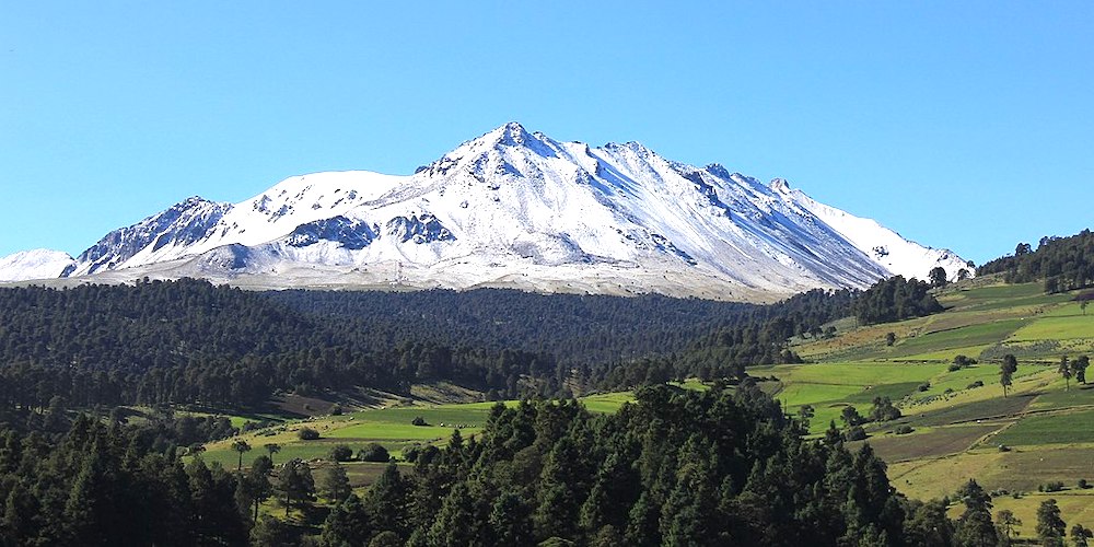
Nevado de Toluca – ©México en Fotos AC CC BY-SA 2.0 via Wikimedia Commons
There are three river basins in the state: the Lerma, the Balsas and the Pánuco. The most important is the Lerma River, which begins in the municipality of Almoloya del Río and passes through a large number of municipalities in the state. The southwestern part of the state is dominated by the Balsas River basin. The eastern panhandle of the state is dominated by the Pánuco River basin. On the various rivers of the state are dams such as José Antonio Alzate in Temoaya, Ignacio Ramirez in Almoloya, Guadalupe in Cuautitlán Izcalli, Madín in Naucalpan, Vicente Guerrero in Tlatlaya, Tepetitlan in San Felipe del Progreso as well as those in Valle del Bravo and Villa Victoria.
Lakes in the state include the Laguna del Sol and Laguna de la Luna in the Nevado de Toluca, the lake in the crater of the Cerro Gorde. Atexcapan Lake in Valle de Bravo, San Simón Lake in Donato Guerra, San Pedro Lake and Concepcion de los Baños Lake and Tepetitlan Lake in San Felipe del Progreso, Acuitzilapan Lake at the food of Jocotitlan volcano, El Rodeo Lake near Xonacatlán, Xibojay and Santa Elena Lakes in Jilotepec and Huapango Lake in Timilpan.
About seventy percent of the state has a temperate moist climate, which consists of the highlands of the Toluca Valley and the areas around Texcoco in the north, the Toluca Valley and the areas around Texcoco. Average year-round temperature varies between 12C and 18C with annual precipitation above 700 millimetres. Higher elevations, about 13% of the state, in the centre and east of the state have a semi-cold climate with average temperatures below 16C. Hotter climes are in the relative lowlands in the south west with have an average temperature of between 18C and 22C and constitute about eight percent of the territory. The hottest regions occupy five percent of the state in the extreme southwest with temperatures averaging over 22C. The coldest areas in the highest elevations such as the Nevado de Toluca, Popocatepetl and Iztaccihuatl. Snow can be found on these elevations year-round. There are some arid areas along the borders of Hidalgo and Tlaxcala with annual precipitation between 500 and 700 millilitres.

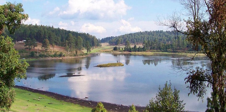
Bosencheve National Park – ©Ildeamitail CC BY-SA 3.0 via Wikimedia Commons
Due to the various climates, the state has a wide variety of flora. 609,000 hectares is covered in tree, most of which is in the temperate and cold climates of the state. In the extreme southwest of the state, rainforests can be found and desert plants in the Hidalgo border area. In the highest altitudes, such as the peak of the Nevada de Toluca, alpine grassland can be found. In the extreme west, there are forests which receive thousands of monarch butterflies each winter.
Birding Mexico State
The state has 49 environmentally protected areas, with the most important being the Nevado de Toluca National Park. Other important areas include the state parks of Otomi-Mazahua, Sierra Morelos, and Nahuatlaca-Matlatzinca. The Bosencheve National Park extends into Mexico State from Michoacán, and is one of the major monarch butterfly sanctuaries. At the far east is the Iztaccíhuatl-Popocatépetl National Park which is shared with neighbouring Puebla state.
From a birder’s perspective, it’s all about habitat, especially in the less inhabited areas. The most import are:
Biospheres – The state is characterised by large plains divided by mountain ranges. To the north is a dry region called ‘Los Llanos’, with vegetation such as mezquites and paddle cactus. In this region there are oak trees and holm oak like in Cuzdha and El Rosal in the municipality of San Miguel Calpulalpan. Toluca and Lerma are in the central valleys, where industrial parks are the source of income. In the surrounding hills, the vegetation consists of pines and oaks. There are white cedars at the National Park of Bancheves. Ocotes, that are aromatic resins, are very common in El Oro, a municipality located in the north-east part of the state. In the central valley are industries and cultivated lands. In the lower, warm elevations to the south, the vegetation is tropical. Here are found guajes, papelillos, acacias, palo de Brasil, guacima and amate.
Mountains & Valleys – The state is divided into two unequal parts: the cross-sectional volcanic axis, which is formed by peaks, the Mountain Range of Queretaro and Hidalgo, and the Sierra Madre del Sur, which is formed by the depression of the Balsas River, in addition to valleys which begin in Guerrero. Inside this system are included the Sierra de Ajusco and Montes de las Cruces, which form a wooded ridge across it from east to west, with a general elevation of about 3000 meters above sea-level. These ranges are part of a broken irregular chain which sometimes bears the name of Anahuac. The most important summits are the Sierra Nevada, the Sierra de las Cruces, Nevado de Toluca and the significant valleys are Toluca-Lerma and Cuautitlan- Texcoco.

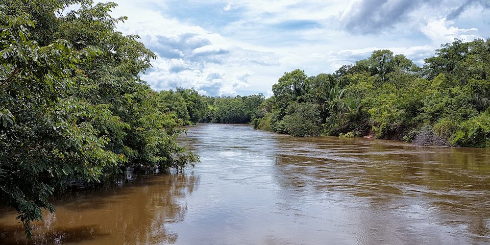
Balsas River – ©Otávio Nogueira BR CC BY 2.0 via Wikimedia Commons
Lakes and rivers – A considerable part of the northern plateau consists of a broad plain, once the bed of a great lake but now covered with swamps, sodden meadows and lakes. The surrounding country drains into this depression, but an artificial diversion of this water has been created by the opening of the Tequixquiac tunnel. The plateau drains westward to the Pacific Ocean via the Lerma River and north-east to the Gulf south of the Sierra de Ajusco. The state is roughly mountainous and drains to the Pacific through tributaries of the Balsas River. It drains to the Gulf of Mexico through the San Juan and Panuco River. Within the depression of the north are the lakes of Zumpango, San Cristobal, Xaltocan, Chalco, Xochimilco and Texcoco, the latter three lying partly or wholly in the Federal District.
-
Wikipedia
GNU Free Documentation License
https://en.wikipedia.org/wiki/México_(state)
-
Number of bird species: 500
(As at December 2024)
-
Avibase
PDF ChecklistThis checklist includes all bird species found in Estado de México , based on the best information available at this time. It is based on a wide variety of sources that I collated over many years. I am pleased to offer these checklists as a service to birdwatchers. If you find any error, please do not hesitate to report them. -
eBird
PDF ChecklistThis checklist is generated with data from eBird (ebird.org), a global database of bird sightings from birders like you. If you enjoy this checklist, please consider contributing your sightings to eBird. It is 100% free to take part, and your observations will help support birders, researchers, and conservationists worldwide.
-
Eagle-Eye Tours
Tour Operator...In the Lerma marshes we seek the beautiful Black-polled Yellowthroat. In pine and fir forests we look for a number of species including the handsome Black-backed Oriole, flashy Red Warbler and elusive Long-tailed Wood-partridge.... -
Field Guides
Tour OperatorThis exciting tour in the Field Guides schedule, inaugurated in 2020, promises top-notch birding from mountains and meadows around Mexico City to the coastal deserts and mangrove lagoons near the tip of Baja.... -
Mexico Birding Tours
Tour OperatorThe Central Volcanic Belt is a rim of Volcanos that cross the country from West to east and divide many of the habitats and ranges for species, but the mountains itself have created some microhabitat that hosts some of the most extraordinary species in the area... -
NatureTrek
Tour OperatorThis tour visits central and south-western Mexico. We begin our holiday in the pre-Aztec city of Teotihuacan, enjoying this superb site, home to the third largest pyramid in the world, as well as a variety of endemic and other birdlife. Next we drive to the Oyamel Fir forests of the central Mexican state...
