
Oriental Republic of Uruguay
Uruguay is a country located in the southeastern part of South America. It is home to less than 3.5 million people, nearly 1.8 million of whom live in the capital Montevideo and its metropolitan area. The economy is largely based on agriculture & forestry and the state sector. Uruguay’s economy is on the whole more stable than in its surrounding states, and it maintains a solid reputation with investors. Uruguay’s only terrestrial border is with Brazil to the north. To the west lies the Uruguay River, to the southwest lies the estuary of Río de la Plata, with Argentina only a short commute across the banks of either of these bodies of water, while to the southeast lies the South Atlantic Ocean. Uruguay has an area of c.176.000 km² (c.68,000 square miles), the third smallest country in South America, only larger than Suriname and French Guiana.
The landscape features mostly rolling plains and low hill ranges (cuchillas) with a fertile coastal lowland. A dense river network covers the country, consisting of four river basins or deltas; the Río de la Plata, the Uruguay River, the Laguna Merín and the Río Negro. The major internal river is the Río Negro. Several lagoons are found along the Atlantic coast. The highest point in the country is the Cerro Catedral at 513.66 meters (1,685 ft 3 in) in the Sierra Carapé hill range. To the southwest is the Río de la Plata, the estuary of the Uruguay River, which forms the western border, and the Paraná River, that does not run through Uruguay itself.
The climate in Uruguay is temperate with warm summers and cold winters. The gently undulating landscape is also somewhat vulnerable to rapid changes from weather fronts. Sometimes polar air in winter, and tropical air from Brazil in summer. Without mountains to act as a barrier, the air masses freely move through, causing abrupt weather changes. The coolest month is June, while the warmest is January. The rainfall is equally distributed throughout the year, although a bit more frequent in the autumn months. There can be frequent thunderstorms in the summer. Although snow is not very common, it does occasionally happen.
Agriculture played such an important part in Uruguayan history and national identity until the middle of the twentieth century that the entire country was then sometimes likened to a single huge estancia (agricultural estate) centred around Montevideo, where the wealth generated in the hinterland was spent. Today, agriculture contributes roughly 11% to the country’s GDP and is still the main foreign exchange earner from meat, dairy and produce, putting Uruguay in line with other agricultural exporters like Brazil, Canada, and New Zealand. Uruguay’s agriculture is neither labour not technologically intensive compared to other such countries, which results in comparatively lower yields per hectare but also allows Uruguay to market its products as ‘natural’ or ‘ecological’.
Birding Uruguay
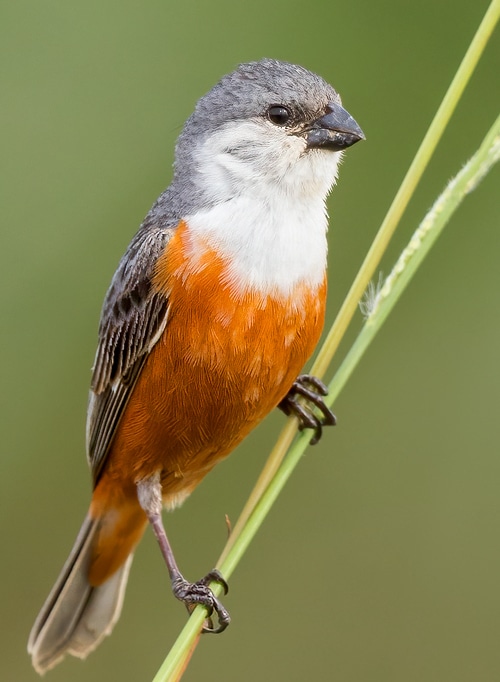
Uruguay’s mix of habitats and decent infrastructure make birdwatching productive. The Pampas in the west region contrasting with the north and northeast’s Atlantic Forest patches. One local indigenous (Guarani) name for Uruguay translates as ‘river of colourful birds’. The name is well deserved as, despite its small size compared with its vast neighbours there are around 500 bird species, meaning it has half of the number of birds of Argentina and a quarter of those of Brazil. From Rheas to Hummingbirds there is a great variety on offer, especially in the riverine and estuary wetlands.
 Esteros de Farrapos
These include the biosphere reserve of Bañados del Este y Franja Costera, the twenty-four Rio Negro islands making up Esteros de Farrapos e Islas del Río Uruguay in the west with its Chestnut Seedeaters and the Saffron-cowled Blackbirds and the 220 birds of the Laguna de Rocha, all are IBAs.
Even the Montevideo metropolitan area can net you 80 species in a day’s birding including the coastal terns gulls and waders with Punta del Este’s Chilean Flamingos. A two-week trip, taking in all the national parks will be sure to mean a bird list of at least 250 species. depending on the season you visit, the coastal wetlands can be teeming with migrants. Further afield, around 300 miles from the capital Crows Ravines National Park offers a different avifauna of grosbeaks and grass-finches, piculets and the hard to get Lesser Yellow-head Vulture. Other local sites offer tyrants and canasteros, hawks and hummers.
Uruguay is a stable and socially progressive democracy with a low density of population surprisingly overlooked by travelling birders as its compact nature makes it eminently birdable.
-
Number of bird species: 526
(As at May 2024)
-
Avibase
PDF ChecklistThis checklist includes all bird species found in Uruguay , based on the best information available at this time. It is based on a wide variety of sources that I collated over many years. I am pleased to offer these checklists as a service to birdwatchers. If you find any error, please do not hesitate to report them. -
Wikipedia
Annotated ListThis is a list of the bird species recorded in Uruguay. The avifauna of Uruguay has 501 confirmed species, of which nine have been introduced by humans, 76 are rare or vagrants, and four are extirpated or believed extinct. An additional eight species are hypothetical (see below). None are endemic. -
eBird
PDF Checklistebird.org/region/UY 519 species (+129 other taxa) - Year-round, All years

-
Aves del Uruguay
| (Lista e Introducción a su Biología y Conservación) | By Adrián B Azpiroz | Adrián B Azpiroz | 2003 | Paperback | 104 pages, colour photos, distribution maps | Spanish | Out of Print | ISBN: 9789974393295 Buy this book from NHBS.com -
Birds in Uruguay and Worldwide Distribution
| By Alejandro Olmos | Biophoto | 2010 | Paperback | 520 pages, Colour photos throughout | English & Spanish | ISBN: 9789974968950 Buy this book from NHBS.com -
Birds of Argentina and Uruguay
| (A Field Guide) | By Tito Narosky & Darío Yzurieta | Vazquez Mazzini Editores | 2011 \ Edition 16 | 432 pages, colour photos, colour illustrations, colour distribution maps | English & Spanish | ISBN: 9789879132272 Buy this book from NHBS.com
-
Neotropical Bird Club
Webpage
-
Universidad de la Rep
WebsiteThe zoology department of the national university
-
Grupo Guayubira
WebsiteAn organisation encouraging conservation of the rain forest etc. El grupo Guayubira, Grupo Ambientalista sobre Montes y Forestaci -
Grupo Uruguayo para el Estudio y la Concervacion de las Aves (GUPECA)
WebsiteGrupo Uruguayo para el Estudio y la Concervacion de las Aves (GUPECA) [Casilla de Correo 6955, Montevideo, Uruguay] Es una organizaci -
Probides
Facebook PagePROBIDES is a Biodiversity Conservation and Sustainable Development Program for the Eastern Wetlands of Uruguay. It has been in existence since 1993, suppported by the UNDP with funds provided by the GEF, the European Union, other International Agencies, and the Uruguayan Government. It is governed by a Board composed of the Municipality of Rocha (where most of the wetlands are located); the University of Uruguay, and the Ministry of Housing, Territorial Planning and the Environment.
-
NP Santa Teresa
InformationSatellite ViewIt is located in the Atlantic coast southeast of Route 9 at the northeast side of Laguna Negra and just north of Punta del Diablo. The area is supervised and maintained by the armed forces. -
NP WII Esteros de Farrapos
InformationSatellite ViewIncludes 24 islands, covering 174.96 km2. Classified under the Ramsar Convention as a Wetland of International Significance.[ -
NR Arboretum Lussich
InformationSatellite ViewDuring December 1979, 182ha (450 Acres approx.) was donated to the Municipality of Maldonado and then opened to the public. The Arboretum Lussich is one of the most important Forest Reserves in the world in terms of its tree species…. -
NR Laguna de Rocha
InformationSatellite ViewUruguay has several coastal lagoons in the southeastern and eastern part of the country. Many of them, including Laguna de Rocha, are comprised in the Biosphere Reserve designated by Man and the Biosphere Program (MAB) of UNESCO… -
WII Ramsar Stes
WebpageSatellite ViewUruguay currently has 3 sites designated as Wetlands of International Importance (Ramsar Sites), with a surface area of 435,837 hectares...
-
Birding Tours Uruguay
Tour OperatorBirding Tours Uruguay offers expert ornithologist guides, with great experience in the important bird areas in the coastal locations of Maldonado and Rocha. -
Birding With Me
Tour OperatorBirding With Me invites you to meet the birds of Uruguay, a country whose Guarani name means "River Of Colorful Birds". This territory has a vast richness of birds as a result of a great diversity of environments. Birdwatching in Uruguay is enjoyable and productive; this country is home to 50 percent of the birds of Argentina and 25 percent of the birds of Brazil, and they can be seen in short distances and in a short time.
-
2018 [01 January] - Håkan Thorstensson
PDF ReportWe also wanted to stay at an estancia and after some searching on the internet, we found a nice-looking one in Uruguay. Punta del Este was regarded a must visit, and adding a couple of areas along the Atlantic coast completed the itinerary. -
2019 [02 February] - Håkan Thorstensson
PDF ReportIn Uruguay, we chose to stay at another estancia than in 2018, adding the towns of Chuy, for easy access to the wetlands, and Piriapolis, for beaching, and also returning to the wonderful Posada de San Antonio. Birdwise, aiming for some regional specialties, we also booked a guided half day at PN Pantanos, formerly known as Reserva Natural Otamendi. Hopefully you will find this report useful, keeping in mind this was not a hardcore birding trip -
2020 [02 February] - Trevor on Tour
ReportWe’ve spent the last ten days discovering the delights of Uruguay – its landscapes, birds and people. -
2022 [12 December] - Marcelo Padua
Report...A little marsh in the town of Rivera also produced many good sightings such as the Striped Cuckoo we saw well in the scope, Blue-and-Yellow Tanager, Large Elaenia and Long-tailed Reed-finch just to name a few...
-
Aves de Uruguay
WebsiteProtection and conservation of the birds of Uruguay -
Aves del Uruguay
Facebook PageAn on line ornithology manual -
Projeto Cardeal-Amarelo
WebsiteEcology and conservation of the critically endangered Yellow cardinal