
Burkina Faso
Burkina Faso is a landlocked country in West Africa, one of the least developed countries in the world. It covers an area of over 274,000 km2 (c.106,000 square miles), bordered by Mali to the northwest, Niger to the northeast, Benin to the southeast, Togo and Ghana to the south, and Ivory Coast to the southwest. As of 2024, the country had an estimated population of a little under 24 million people. Previously called the Republic of Upper Volta (1958–1984), it was renamed Burkina Faso by President Thomas Sankara. Its citizens are known as Burkinabè, and its capital and largest city is Ouagadougou with about 3.5 million inhabitants.
It is made up of two major types of countryside. The larger part of the country is covered by a peneplain, which forms a gently undulating landscape with, in some areas, a few isolated hills, the last vestiges of a Precambrian massif. The southwest of the country, on the other hand, forms a sandstone massif, where the highest peak, Ténakourou, is found at an elevation of 2,500 feet. The massif is bordered by sheer cliffs up to 500 feet high. The average altitude of Burkina Faso is 1,300 feet and the difference between the highest and lowest terrain is no greater than 2,000 feet. Burkina Faso is therefore a relatively flat country.
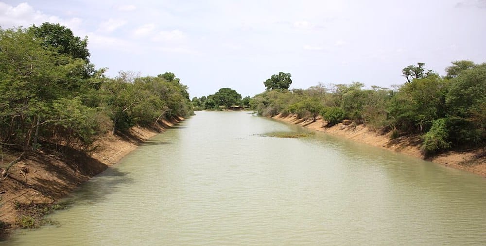
The Black Volta – ©Marco Schmidt CC BY-SA 3.0 via Wikimedia Commons
The country owes its former name of Upper Volta to three rivers which cross it: the Black Volta (or Mouhoun), the White Volta (Nakambé) and the Red Volta (Nazinon). The Black Volta is one of the country’s only two rivers which flow year-round, the other being the Komoé, which flows to the southwest. The basin of the Niger River also drains c.30% of the country’s surface. The Niger’s tributaries – the Béli, Gorouol, Goudébo, and Dargol – are seasonal streams and flow for only four to six months a year. They still can flood and overflow, however. The country also contains numerous lakes – the principal ones are Tingrela, Bam, and Dem as well as large ponds, such as Oursi, Béli, Yomboli, and Markoye. Water shortages are often a problem, especially in the north of the country. Burkina Faso lies within two terrestrial ecoregions: Sahelian Acacia savanna and West Sudanian savanna.
Burkina Faso has a primarily tropical climate with two very distinct seasons. In the rainy season, the country receives between 24 and 35 inches of rainfall; in the dry season, the ‘harmattan’ blows (a hot dry wind from the Sahara). The rainy season lasts around four months, May/June to September, but is shorter in the north of the country. Three climatic zones can be defined: the Sahel, the Sudan-Sahel, and the Sudan-Guinea. The Sahel in the north typically receives less than 24 inches of rainfall per year and has high temperatures, up to 47 °C. A relatively dry tropical savanna, the Sahel extends beyond the borders of Burkina Faso, from the Horn of Africa to the Atlantic Ocean, and borders the Sahara to its north and the fertile region of the Sudan to the south. The Sudan-Sahel region is a transitional zone with regard to rainfall and temperature. Further to the south, the Sudan-Guinea zone receives more than 35 inches of rain each year and has cooler average temperatures. Periodic floods and drought make agriculture prone to failure, as does its vulnerability to insect swarms.
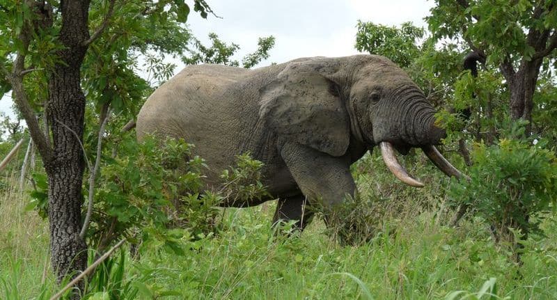
Male elephant in the Nazinga Reserve – ©Oliviertl, CC BY-SA 3.0 via Wikimedia Commons
Burkina Faso has a larger number of elephants than many countries in West Africa. Lions, leopards and buffalo can also be found here, including the dwarf or red buffalo, a smaller reddish-brown animal which looks like a fierce kind of short-legged cow. Other large predators live in Burkina Faso, such as the cheetah, the caracal or African lynx, the spotted hyena and the African wild dog, one of the continent’s most endangered species. Wildlife is protected in four national parks: The W National Park in the east which passes Burkina Faso, Benin, and Niger; the Arly Wildlife Reserve (Arly National Park in the east); the Léraba-Comoé Classified Forest and Partial Reserve of Wildlife in the west and the Mare aux Hippopotames in the west, as well as a number of nature reserves.
Birding Burkina Faso
Faso Burkina Faso has been called the honest men’s land, and was one of the easiest and safest countries in Western Africa, but political instability and Islamist incursions has marred that reputation. It has an impressive list of birds (over 500 species, thanks to its location between Sahelian, in the north, and tropical forest habitats, in the south) and a fantastic and well-preserved variety of game and mammals, which make it a must-visit location for pioneer birders.
Burkina Faso is a land locked country in the West African Sahel region sandwiched between the Sahara Desert and the Gulf of Guinea, within the loop of Niger River. Water is scarce in many parts of the country, and where it is available, infestations of river blindness or sleeping sickness prevented its use for agriculture for centuries. Burkina Faso is home to 60 different ethnics groups but is dominated by Voltaic group which include the Mossi, who make 52 per cent of the population. Burkina Faso is also one of the more densely populated countries in the Sahel, three quarters of whom live in the rural area. Small-scale agricultural and animal husbandry occupies 90% of the population.
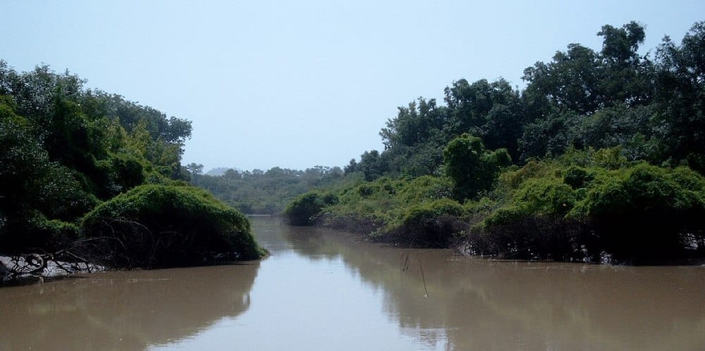
Arly National Park – ©Marco Schmidt, CC BY-SA 3.0 via Wikimedia Commons
Birding in Burkina is pioneering birding, you’ll have to travel with this in mind. Tourism is under-developed and game ranches, national parks or wildlife reserves are the usual destinations for visitors. Independent birders won’t have trouble finding 4-wheel drive vehicles and guides but as birding is an unusual activity, you may need to explain your wishes. Although some parks may be open throughout the entire year (excepted Arly NP); the rainy season frequently transforms the paths and tracks into impracticable muddy swamps, while the green sea of high tropical grasses can complicate the viewing of the wildlife. For these reasons, the best period for visiting Burkina Faso is from (mid-October) November to June or mid-July. If you can book one an organised tour gives you the benefit of up-to-date local knowledge.
This introduction has been extracted and modified from: Birding in Burkina Faso – more than just birdwatching by Portier, Lungren & Oueda (2002 – first published in Dutch Birding. 24, n°3, pp 127-141). It was submitted by Bruno Portier, one of the authors, and is reproduced here with his permission.
-
Beli River, Partial Wildlife Reserve
Satellite ViewThe Béli River site lies in the extreme north of the country. It is a flat scrub steppe at 250-300 m of altitude, interspersed with ancient sand dunes covered with short grasses, large eroded flats and shallow thalwegs. Draining out of Mali, the seasonal Béli River is a shallow drainage forming clusters of small lakes that progressively dry up after the rains. The most important birding areas are presently considered to be the clusters of shallow ponds located about the nomad camps of Tin Akoff, Fader Fadar and In Tangoum, where a waterbird congregation of over 20,000 birds from November to March is to be expected. There, as in the Oursi area, it is probable to find several species restricted to the Sahel Biome. -
Bérégadougou Hill and Banfora Cliffs
Satellite ViewSituated in southwest Burkina, to the north of the town of Banfora, Bérégadougou hill covers approximately 15,000 ha, of which 5,000 ha is a forest reserve. The hill is actually a chain of hills and peaks formed of weathered sedimentary rocks that reach an altitude of 680 m, rising about 350 m above the valley of the Comoé to the east. The area is the source of several of the country's largest rivers including the Comoé and the Mouhoun. Vegetation along the flanks of the hill is more or less dense, dominated by Combretum velutinum, Swartzia madagascariensis, Hymenocardia acida, Afrormosia laxiflora, Burkea africana, Combretum nigricans, Parinari curatellifolia, Parinari polyandra, Cassia sieberiana and Terminalia sp. Cola cordifolia is numerous and, in places, forms dense groves. Annual rainfall is between 1,000 and 1,100 mm. Near the town of Banfora, run-off from the hill forms a considerable number of successive water falls, tumbling over and around rock formations (Karfiguela falls). Extending from the base of the hill and running north-east for about 110 km, the Banfora Cliffs terminate near the city of Bobo-Dioulasso, which is the second largest city of Burkina. In many places the cliffs are fissured, forming hundreds of rock columns along the edge of the escarpment, with a multitude of nesting and hiding places for the many forms of bird, reptile, small mammal and insect that inhabit the cliffs. Near Bobo-Dioulasso, you can have a walk in Dafra, a place where you will sea sacred fish, and spent a good birding trip. The Guingette, at about 15 km from Bobo, is a spot of dense forest along a fresh water spring where many forest birds will be found easily. Back from Karfiguela falls, you can have a tour in Tengrela lake to spot the Lesser Jacana Microparra capensis and to approach with a pirogue a small herd of hippos. -
Comoé-Léraba
Satellite ViewIn the southwestern edge of the country, along the border with the Ivory Coast which is formed by the Comoé and Léraba rivers, this sector encloses the classified forests of Diéfoula and Logoniégué. They are presently the object of the GEPRENAF programme, which aims to establish village-owned commercial wildlife production. This is the wettest zone of Burkina with about 1300 mm of annual rainfall. The vegetation formations are particular to the area, as characterised by semi-deciduous gallery forests of 30-40 high and tall dry forests of 15-20 m. Despite the fact that very few is known about the birdlife in the area, the site should produce some interesting sightings. As well, Hippos which are common on the site, Elephant, Leopard Panthera pardus and Caracal Felix caracal may be observed. -
Gonsée Classified Forest
Satellite ViewThis suburban forest is managed for the production of utility wood. It is located at just half-an-hour drive from Ouagadougou, on the road eastward heading to Fada N'Gourma. If your time is limited, you could also spend just half-a-day birding here. We strongly recommend you to prolong your visit until dusk when some night birds will show in the beams of your car lights. -
Kompienga Lake
Satellite ViewIn the southeast of the country, the hydro electric dam of Kompienga is one of the largest in Burkina, with a capacity of 2,000,000 m3 of water. The vegetation surrounding the lake is typical of that of the Pendjari - Mékrou sector of the southern Sudan savannah, although moist pastures and gallery forests are developing in places along the lake shore. There is, as yet, little ornithological information available; it is, however, thought more than 20,000 waterbirds. Elephant and the occasional herd of Roan, Bubal Hartebeest, and Topi Damaliscus lunatus korrigum come to the lake during the dry season from the hunting concessions located just to the east. Affordable accommodations will be found in the Hotel de Brousse de la Kompienga near Pama (+ 226 318443). -
Mare aux hippopotames
Satellite ViewThe site is located about 50 km north of the city Bobo-Dioulasso, in the upper Mouhoun valley. There is a 600 ha lake (Ramsar site) lying within a classified forest (World Biosphere Reserve). At the end of the dry season, the lake is reduced to about 120 ha covered with dense aquatic vegetation. The annual cycle progressively exposes a large flood plain that provides fodder for a hippo herd which occupies the lake; sometimes sharing the shores with elephants coming out of the nearby Maro Reserve. While 243 species of birds have been identified at the site as a whole, mainly large numbers of waterbirds inhabit the lake and its flood plain. But, as well, some species that are difficult to see elsewhere in Burkina can be found here. -
Nazinga Game Ranch
Satellite ViewSituated 200 km south of Ouagadougou along the Ghanaian border, the Nazinga Game Ranch is a 91,300 ha wildlife ecosystem favourable to the conservation of birds and mammals, where well-managed game viewing and safari hunting of large ungulates are offered. Accommodation is available all the year round nevertheless it is strongly recommended to book rooms and meals before your arrival (Tel.: + 226 318443 / + 226 413617). Lights go off at 10.00 p.m., probably to ensure guests get plenty of sleep before rising at the crack of dawn, the most favourable moment for observing the local wildlife. Professional trackers will guide you through the ranch, along the 450 km of bush tracks, to discover the great diversity of habitats and the variety of its wildlife fauna. Since 1979, 11 dams have been created on some major seasonal streams to retain water most of the year. These sites improved the variety of habitats and attract a varied fauna in the dry season. An observatory situated in the campground will allow you to observe a great diversity of wildlife at just few meters of your room. The dominant landform in the area is flatland plains that slope gently toward drainage channels. The vegetation is typical of south Soudanian / north Guinean savannah, with galleries and riparian forests along rivers, and a patchwork of scrub, tree and woodland savannah on the drier soils.At only a three-hours drive from Ouagadougou, Nazinga is the best spot to see elephants (Loxodonta africana); of which about 500 are living in the area, and a great diversity of wild African mammals as warthogs, antelopes, monkeys. Up to 330 bird species have been recorded in Nazinga Game Ranch, including seven (7) species of Stork, forty-three (43) species of diurnal raptor, five (5) species of Nightjar, seven (7) species of Bee-eater, fourteen (14) species of Swallow and Martin. In the last two years Nazinga has offered three new species for the birds that are to be found in Burkina. It is interesting to note that a training course organized by Birdlife Int. in November 2000 provided a list of 185 species observed in only 6 days of birdwatching. Its southern gives Nazinga the possible occurrence of some over-lapping Afro-tropical migrants, or birds in their northernmost territories. Many Palearctic migrants will also be present from October to March, mainly waders, raptors and insectivores. -
Ouagadougou Classified Forest
Satellite ViewSituated near the centre of Ouagadougou, just in front of the hotel Sofitel Silmandé, the Ouagadougou Classified Forest (currently designated as the Parc Urbain de Bangré Weogo); is formed by small patches of scrub and tree savannah, savannah woodland and small riparian forests on hydromorphic soils. The site is currently the object of considerable efforts by the government to establish it as a recreational nature centre. Despite the fact that no particular species that could not be seen elsewhere in the country will be recorded here, the site is worth a visit for those that have only short time to spend birding in Burkina. Well over 200 species have been recorded in the area and a few hours birding here can provide many West African specialities. -
Oursi – Darkoye Lakes, Sahel Partial Reserve
Satellite ViewThis site consists of seasonal lakes at the foot of old sand dunes (Oursi); on open steppe (Darkoy, Kouyéra, Yomboli, Kisi, Bangao) or at the foot of hills (Tin Edia) situated north-east of the country. The landscape is made by sand dunes, open eroded shields, drainage lines, inselbergs rising out of the plains and a series of hills that usually lie upstream of the lakes. Depending entirely upon the annual rainfall runoff from the rains of July to September, lakes levels vary considerably from year to year. -
Sourou Lake (unprotected)
Satellite ViewNear the western edge of the country in the northern Sudan sector, the Sourou River rises out of Mali and flows south into the Mouhoun River. A passage of 55km, the Sourou Lake, is permanently flooded since the construction of a dam at the junction of the two rivers. The lake varies from several hundred meters to 4 km wide and provides habitat of vast shallows covered with long perennial grasses. Thousands of waterfowl are present even if no other specialities compared to both previous sites are to be expected. A major attraction will undoubtly be the Hippos Hippopotamus amphibius you will see swimming or walking on the banks. -
W – Arli – Singou complex
Satellite ViewThe W National Park (235,000 ha); Arli National Park (76,000 ha) and the Singou-Game Ranch (193,000 ha) are surrounded by classified forests and non-classified lands forming hunting concessions and village hunting zones. While these different blocks form the largest remaining wilderness in Burkina, it is even more significant in that it extends on into Benin and Niger, thus more than doubling the area available to wildlife. But situated at the extreme South-eastern edge of the country, it will take you up to 3 or 4 days to visit the area, while W NP is simply not open to tourists. The Arly Hotel complex contains accommodations for guests, a restaurant and a swimming pool (open from Dec 1st to May 30th, + 226 791579 / + 226 330983). This is the best place where to stay if you visit the area. You will need a 4-WD car to get there but Arly NP is worth a visit since it is virtually the only wildlife area where you will be authorised to learn the unique experience of trekking (foot) safaris, instead of being confined to your vehicle as it frequently occurs in other African wildlife reserve. The result is a first-hand, direct contact with nature, during which the visitors will learn the ancestral art of tracking animals as silently as traditional hunters. Nevertheless, to minimize any potential risk, every trekking safari is accompanied by an armed guide perfectly familiar with the park and the habits of its animal population. Nothing common with the world of East African national parks and their convoys of jam-packed jeeps and buses crowding round the star animals. Along the Pendjari and Mékrou rivers, larges stands of Borassus palms Borassus aethiopum situated along the drainage lines provide favourable habitat for many birds. In the east of Arli National Park, a rocky ridge forms the Gobnangou cliffs that run for 50 km through the north of the park while several buttes (in particular Pagou) tower up into the sky and provide important nesting sites for raptors.
-
Number of bird species: 515
(As at August 2024)
-
Avibase
PDF ChecklistThis checklist includes all bird species found in Burkina Faso , based on the best information available at this time. It is based on a wide variety of sources that I collated over many years. I am pleased to offer these checklists as a service to birdwatchers. If you find any error, please do not hesitate to report them. -
Wikipedia
Annotated ListThis is a list of the bird species recorded in Burkina Faso. The avifauna of Burkina Faso include a total of 515 species. One species listed is extirpated. -
eBird
PDF ChecklistThis checklist is generated with data from eBird (ebird.org), a global database of bird sightings from birders like you. If you enjoy this checklist, please consider contributing your sightings to eBird. It is 100% free to take part, and your observations will help support birders, researchers, and conservationists worldwide.

-
Birds of Western Africa
| By Nik Borrow & Ron Demey | Christopher Helm | 2014 | Edition 2 | Paperback | 592 pages, 266 plates with colour illustrations; colour distribution maps | ISBN: 9781472905680 Buy this book from NHBS.com -
Birds of Western and Central Africa
| By Ber van Perlo | Princeton University Press | 2003 | Paperback | 384 pages, 109 plates with colour illustrations; colour & b/w illustrations, 1500+ b/w distribution maps, colour maps | Out of Print | ISBN: 9780691007144 Buy this book from NHBS.com
-
African Bird Club
WebsiteBurkina Faso is possibly one of the safer countries in Africa with friendly people, a good tourist infrastructure and travel connections. Perhaps surprisingly for the birdwatcher, it has a good range of species because the country spans an area from the Sahel in the north to tropical forests in the south. There has been little ornithological investigation so it would make a good destination for the independent minded birder -
Fondation des Amis de Ia Nature (NATURAMA)
Facebook Page01 B.P. 6133, Ouagadougou 01 BURKINA FASO. +226 36 5119 naturama@fasonet.bf [Contact - M. Georges H. OUEDA, also Birdlife Representative in Burkina Faso and African Waterbird Census national coordinator for Burkina Faso.] -
West African Ornithological Society
WebsiteThe West African Ornithological Society grew out of the Nigerian Ornithologists
-
NP Arli
InformationSatellite ViewArli National Park, often called Arly, is a national park located in Tapoa Province, southeastern Burkina Faso. It adjoins Benin's Pendjari National Park in the south and the Singou Reserve in the west. It is home to around 200 African elephants, 200 hippos and 100 lions. There are also buffaloes, baboons, red and green monkeys, warthogs, and various antelopes, such as the western hartebeest and roan antelope. There are also bushbucks, duikers and waterbuck. -
NP Deux Balés
InformationSatellite ViewThe Park has been called "an area of about 200,000 acres (810 km2) of bushland and aging baobab trees". The vegetation comprises Sudano-Zambezian savanna with a carpet of grasses, and trees such as Anogeissus leiocarpus, Isoberlinia doka and Terminalia laxiflora. There is gallery forest on the riverbanks -
NP Kaboré Tambi
InformationSatellite ViewKaboré Tambi National Park is a national park in Burkina Faso. It is situated between Ouagadougou and the border with Ghana and follows the course of the Nazinon river. Founded in 1976 as Pô National Park, it has been renamed in honor of a ranger of the park who was killed by poachers in 1991. -
NP Mare aux Hippopotames
InformationSatellite ViewThe park was created around a freshwater lake and includes surrounding pools and marches in the flood plain of the Black Volta River, and surrounding forests. Mare aux Hippopotames is among the wetlands of international importance as defined by the Ramsar Convention. -
NP W
InformationSatellite ViewThe W National Park (French: Parc national du W) or W Regional Park (French: W du Niger) is a major national park in West Africa around a meander in the River Niger shaped like the letter W. The W National Park is also known for its bird populations, especially transitory migrating species, with over 350 species identified in the park. The park has been identified by BirdLife International as an Important Bird Area... -
NR Bontioli
InformationSatellite ViewBontioli Reserve is a complete reserve in Burkina Faso. Established in 1957 it is located in Bougouriba Province and covers an area of 127 km2 (49 sq mi). -
NR Madjoari
InformationSatellite ViewMadjoari Reserve is a complete reserve in Burkina Faso. Established in 1970 it is located in Tapoa Province and covers an area of 170 km². -
NR Singou
InformationSatellite ViewSingou Reserve is a complete reserve in Burkina Fas -
WII Mare d'Oursi
InformationSatellite ViewThe Mare d'Oursi is a small, shallow lake in Oudalan Province in northern Burkina Faso, close to the town of Oursi. It is included in the List of Ramsar wetlands of international importance.
-
eBird
Sightings
-
Biodiversity in Burkina Faso
WebsiteIncludes parks, preserves, lists of fauna etc.