
Coral Sea Islands Territory
The Coral Sea Islands Territory is an external territory of Australia which comprises a group of small and mostly uninhabited tropical islands and reefs in the Coral Sea, north-east of Queensland, Australia. The only inhabited island is Willis Island. The territory covers 780,000 km2 (301,160 square miles), most of which is ocean, extending east and south from the outer edge of the Great Barrier Reef and includes Heralds Beacon Island, Osprey Reef, the Willis Group and fifteen other reef/island groups. Cato Island is the highest point in the Territory.
There are about 30 separate reefs and atolls, twelve being wholly submerged or drying only during low tide, and 18 others with a total of about 51 islets and cays (18 alone on the atoll Lihou Reef), some of which are vegetated. The atolls exhibit a wide range of size, from a few kilometres in diameter to perhaps the second largest atoll in the world by total area (including lagoon): Lihou Reef, with a lagoon size of 100 by 30 kilometres (62 by 19 miles) and an area of 2,500 square kilometres (970 square miles), which compares to a combined land area of the 18 individual islets of only 0.91 square kilometres (0.35 square miles). The islands are all very low. Some automatic, unmanned weather stations are located on several reefs and atolls and others have lighthouses.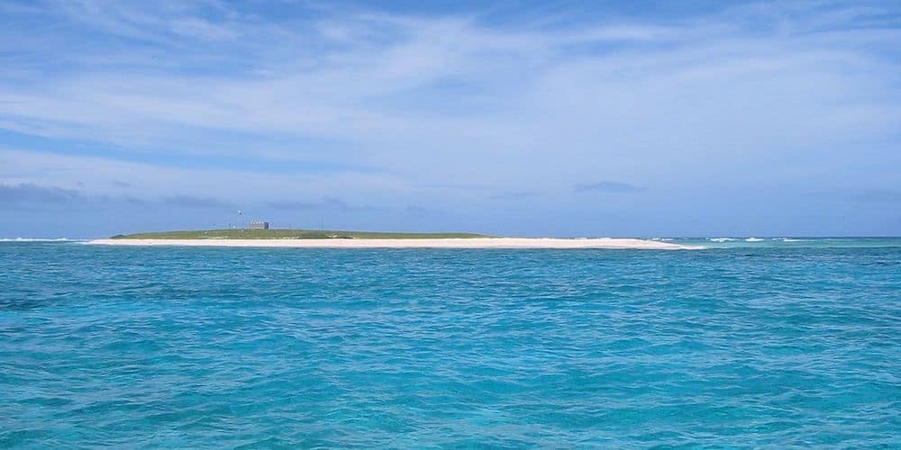
Cato Island – ©Johan Willemsen CC BY-SA 3.0 via Wikimedia Commons
The Willis Islets are important nesting areas for birds and turtles but contain negligible natural resources. They comprise less than three square kilometres (1.2 square miles) of land. There is no port or harbour, only offshore anchorage. There is no economic activity, and only a staff of three or four people to run the meteorological station – the entire population of the territory. Most of the atolls fall into two groups, while Mellish Reef to the east, and Middleton Reef and Elizabeth Reef to the south are grouped separately.
Birding the Coral Sea Islands Territory
The Coral Sea Marine Park covers 989,836 square kilometres and is one of the world’s largest marine parks. Apart from marine fish spawning grounds, six of the world’s seven species of marine turtles nest or are found in the area.
The Coral Sea National Nature Reserves comprises of the Coringa-Herald National Nature Reserve and the Lihou Reef National Nature Reserve. Its cays provide near-pristine nesting habitat for several threatened birds. Coringa-Herald National Nature Reserve is located in the central Coral Sea, its centre being about 440 km east of Cairns, Queensland. Lihou Reef National Nature Reserve is also located in the central Coral Sea, its centre being about 650 km east-south-east of Cairns and 200 km east-south-east of Coringa-Herald National Nature Reserve. The area is recognised as a Ramsar Wetland of International Importance. Thick forests of Pisonia grandis (a flowering tree in the Bougainvillea family) grow on North East Herald Cay and South East Magdelaine Cay. Globally rare, pisonia forests play an important role in supporting seabird populations by providing shelter and nesting habitat.
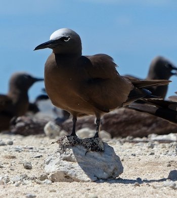
Species that depend on the cays for their survival in the region include Red-footed & Masked Booby, Greater & Lesser Frigatebird, Red-tailed Tropicbird, Common & Black Noddy, Bridled, Crested, Sooty & Black-naped Terns. crested and sooty terns. The density of bird life here in the breeding season is hard to imagine. For example, the tiny North East Herald Cay, less than half a square kilometre in size, hosts over 500 pairs of Red-tailed Tropicbirds and more than 1,400 pairs of Frigatebirds. Betrween 60,000 and 130,000 pairs of Wedge-tailed Shearwaters breed on a number of Coral Sea cays every year. Cato Island includes key colony areas for breeding populations of 1,050-6,000 Brown Boobies and 200,000-400,000 Sooty Terns.
The Coral Sea cays are also a vital stopover for migrating seabirds.
-
MR Coral Sea Commonwealth
Information -
NNR Lihou Reef
InformationLihou Reef National Nature Reserve is a former marine protected area covering an area of 8440 km2in the Australian Coral Sea Islands Territory that was incorporated into the new Coral Sea Commonwealth Marine Reserve in December 2012.
-
Wikipedia
GNU Free Documentation License
http://en.wikipedia.org/wiki/Coral_Sea_Islands
-
Number of bird species: 47
(As at April 2024)
-
Avibase - Bird Checklists of the World
PDF ChecklistThis checklist includes all bird species found in Coral Sea Islands , based on the best information available at this time. It is based on a wide variety of sources that I collated over many years. I am pleased to offer these checklists as a service to birdwatchers. -
Wikipedia
Annotated ListThis is a list of the bird species recorded on the Coral Sea Islands. The avifauna of the Coral Sea Islands include a total of 45 species.
-
Coral Sea Reserves Ramsar Site
InformationSatellite ViewThe site was designated as a wetland of international importance under the Ramsar Convention on Wetlands. It was listed on 21 October 2002 as Ramsar Site 1222. -
MR Coral Sea Commonwealth Marine Reserve
InformationSatellite ViewThe Coral Sea marine region is a remote ocean ecosystem recognised for its unique physical, ecological and heritage values. The environmental significance of the Coral Sea lies in its diverse array of coral reefs, sandy cays, deep sea plains and canyons. The Coral Sea islands and associated reefs support critical nesting sites for the green turtle and a range of seabird species such as noddies, terns, boobies, frigatebirds and tropic birds. -
NNR Coringa-Herald
InformationSatellite ViewCoringa-Herald National Nature Reserve is a former nature reserve in Australia’s Coral Sea Islands Territory that was incorporated into the new Coral Sea Commonwealth Marine Reserve in December 2012 -
NNR Lihou Reef
InformationSatellite ViewLihou Reef National Nature Reserve is a former marine protected area covering an area of 8440 km2 in the Australian Coral Sea Islands Territory that was incorporated into the new Coral Sea Commonwealth Marine Reserve in December 2012