Free and Sovereign State of Michoacán

Michoacán is one of the 31 constituent states of Mexico. This centre-western state borders the states of Colima and Jalisco to the west, Guanajuato to the north, Querétaro to the northeast, México to the east, Guerrero to the southeast, and the Pacific Ocean to the south. It has an area of just under 59,000 km² (c.23,600 square miles). It is the sixteenth largest state in Mexico, taking up 3% of the national territory.
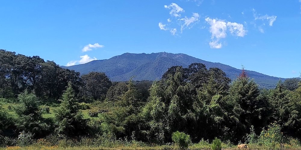
The state is crossed by the Sierra Madre del Sur, the Trans-Mexican Volcanic Belt and the Inter-mountain Valleys region. The Sierra Madre del Sur crosses the state northwest to southeast for approximately 200 km (120 mi) in the southwest between the municipalities of Chinicuila and Arteaga along the Pacific Coast. It is considered to be a continuation of the Sierra Madre Occidental. Peaks in this range average about 2,900 m (9,500 ft) above sea level, with the largest being the Cerro de las Canoas. The Trans-Mexican Volcanic Belt crosses the state from west to east toward the Toluca Valley and Valley of Mexico. This mountain range is marked by appearance of many volcanoes, active, dormant, and extinct alike. This system is subdivided into regions such as the Sierra de Tancítaro, Sierra de Periban, Sierra de San Angel and others. The best-known volcano in this region is the Paricutín volcano.

Cerro Patamban – ©Mauricio C CC BY-SA 4.0 via Wikimedia Commons
The state has a large number of lakes, waterfalls, lagoons, hot springs, and a natural system of waterways, including parts of two of the country’s largest rivers, the Lerma and the Balsas. Rivers that empty into the Lerma in include the Tlalpuhahua, Cachivi and Duero. Another river basin here is that of Lake Cuitzeo, which extends over an area of over 3,600 m2. The two main rivers that feed this lake are the Grande de Morelia and Queréndaro. The Central region has lakes Pátzcuaro and Zirahuén. Lake Pátzcuaro is fed by a number of surface and subterranean water flows with the principal rivers leading here including the San Gregorio and Chapultepec. This lake has five islands within it called Janitzio, Yunuén, La Pacanda, Tecuén, Jarácuaro, Urandén and Carián. Lake Zirahuén and is fed by streams such as Manzanilla and Zinamba. These two lakes are considered to be the main tourist attraction of the state.
Much of the climate of the state is determined by altitude and other geographical features. Average temperatures vary from 13 °C to 29 °C. Lower temperatures correspond with the highland areas in the north and east while the lower south and west, called La Costa (the coast) or Tierra Caliente (hot land) register higher temperatures. In the hotter lowlands, high temperatures regularly exceed 30 °C
and have been known to reach over 40 °C in the summer. The lowest temperatures are registered in highland areas such as the Sierra de Coalcomán and the Sierra del Centro located near the border with the State of Mexico. Except for the Tierra Caliente, most of the state can experience freezing temperatures in the winter. Rainfall is also dependent on altitude with the lowlands receiving less rain than the mountain areas. There is a well-defined rainy season which extends from June to October over the entire state.

The coast at Maruata – ©Noé-González CC BY-SA 4.0 via Wikimedia Commons
Dominated by the mountains, Michoacán extends from the Pacific Ocean northeastward into the central plateau. The climate and soil variations caused by this topography make Michoacán a diverse agricultural state that produces both temperate and tropical cereals, fruits, and vegetables.
Birding Michoacán
Sixty percent of the state is covered in forest, with the most economically important of these located in the higher elevations at the eastern side. These forests mostly produce lumber and resin. These areas are estimated at 2,160,000 hectares, over half of which is pine forest. The most productive forests are located in the central and eastern portions of the state. Rainforest areas are estimated at 460,500 hectares. One problem facing the forested areas of the state is unsustainable logging. In addition to exploitable forest, there are also ecological reserves, especially the various monarch butterfly sanctuaries in the extreme east of the state.
The area around Angangueo and Ocampo in northeast Michoacán is famous for the monarch butterflies, most of the eastern North American population, that spend 6 winter months in the surrounding forests of Oyamel. Mammals species include jaguar, jaguarundi, cougar, onza, ocelot, margay, coyote.

NP Barranca del Cupatitzio – ©Rafaelalvarezqro CC BY-SA 4.0 via Wikimedia Commons
Protected areas in Michoacán include Barranca del Cupatitzio, Bosencheve, Cerro de Garnica, Insurgente José María Morelos, Lago de Camécuaro, and Rayón national parks, Monarch Butterfly and Zicuirán-Infiernillo biosphere reserves, and Pico de Tancítaro Flora and Fauna Protection Area. Lake Pátzcuaro and Zacapu Lagoon are Ramsar Sites, designated wetlands of international importance.
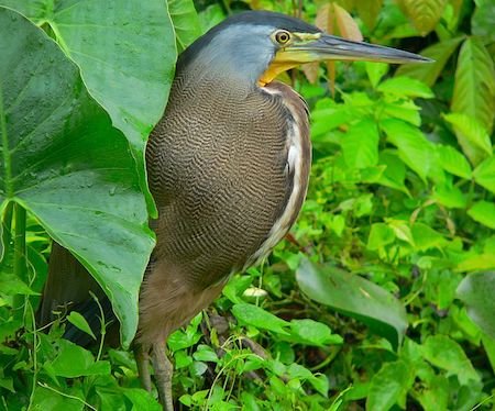
Numerous bird species can be found including water fowl such as ducks, storks and seabirds along the coast. Some of the birds of the state are Chachalaca, Roadrunner, Caracara, Groove-billed Ani locally known as ‘chicuaro’, and the Great Horned Owl. Both owls and hummingbirds are important cultural symbols to the Purépecha.
-
Wikipedia
GNU Free Documentation License
https://en.wikipedia.org/wiki/Michoacán
-
Number of bird species: 593
(As at December 2024)
Number of endemics: 1 Breeding Endemic
Craveri's Murrelet Synthliboramphus craveri
-
Avibase
PDF ChecklistThis checklist includes all bird species found in Michoacán , based on the best information available at this time. It is based on a wide variety of sources that I collated over many years. I am pleased to offer these checklists as a service to birdwatchers. If you find any error, please do not hesitate to report them. -
eBird
PDF ChecklistThis checklist is generated with data from eBird (ebird.org), a global database of bird sightings from birders like you. If you enjoy this checklist, please consider contributing your sightings to eBird. It is 100% free to take part, and your observations will help support birders, researchers, and conservationists worldwide.
-
Mexico: Pacific Coast Birds
| By Robert Dean | Rainforest Publications | 2014 | Unbound | 14 pages, colour illustrations | ISBN: 9781888538403 Buy this book from NHBS.com
-
ecoTOURS
Tour Operator
-
Casa Camelinas
AccommodationWe invite you to enjoy the beauty, peace and hospitality of Casa Camelinas, where a warm, friendly ambiance and gracious personal service await you. -
Hotel Mansion Iturbe
AccommodationCompletely restored to its former splendor, the Mansion boasts a beautiful colonial decor combining antiques and Purepechan art. The 14 rooms and suites are individually decorated and furnished with heavy, dark Spanish-style wooden furniture. The majority of the rooms have a private balcony overlooking either Don Vasco Square or Iturbe Street.

