Free and Sovereign State of Coahuila de Zaragoza

Coahuila is one of the 32 states of Mexico. It borders the Mexican states of Nuevo León to the east, Zacatecas to the south, and Durango and Chihuahua to the west. To the north, Coahuila accounts for a 512 kilometres (318 mile) stretch of the Mexico–US border, adjacent to the US state of Texas along the course of the Rio Grande (Río Bravo del Norte). With an area of more than 151,500 square kilometres (c. 58,500 square miles), it is the nation’s third-largest state. It comprises 38 municipalities (municipios). Coahuila has a population of over 3.25 million inhabitants. The largest city and State Capital is the city of Saltillo with over a million inhabitants; the second largest is Torreón (but is the largest metropolitan area in Coahuila and 9th largest in Mexico with c.1.5 million people).The Sierra Madre Oriental runs northwest to southeast through the state, and the higher elevations are home to the Sierra Madre Oriental pine-oak forests. East of the range, the land slopes gently toward the Rio Grande, and is drained by several rivers, including the Salado and its tributary the Sabinas.

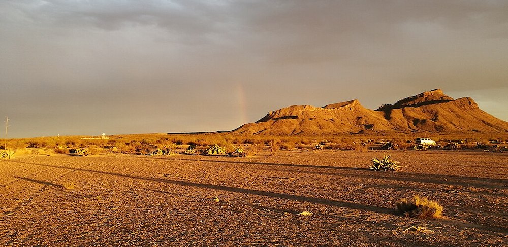
Bolsón de Mapimí Biosphere Reserve – ©José Antonio Aranda Pineda CC BY-SA 4.0 via Wikimedia Commons
The Tamaulipan mezquital, a dry shrubland ecoregion, occupies the western portion of the state, and extends across the Rio Grande into southern Texas. The portion of the state west of the Sierra Madre Oriental lies on the Mexican Plateau, and is part of the Chihuahuan Desert. The Bolsón de Mapimí is a large endorheic basin which covers much of the western portion of the state and extends into adjacent portions of Chihuahua, Durango, and Zacatecas. The Nazas River, which flows east from Durango, and the Aguanaval River, which flows north from Zacatecas, empty into lakes in the Bolsón. Torreón, the most populous metropolitan area in the state, lies on the Nazas in the irrigated Laguna Region, the (Comarca Lagunera), which straddles the border of Coahuila and Durango. The state is largely arid or semi-arid, but the rivers of the state support extensive irrigated agriculture, particularly cotton. The Parras district in the southern part of the state produces wines and brandies. The pine-oak forests of the Sierra Madre produce timber.
Birding Coahuila
The state contains two biosphere reserves. Maderas del Carmen lies on the northern border of the state, and includes sections of the Chihuahuan desert and sky islands of pine-oak forest in the Sierra del Carmen.
The springs, lakes, and wetlands of Cuatro Ciénegas lie west of Monclova on the west slope of the Sierra Madre.
Being a large state with a relatively small population, which is largely urban, much of the state is undeveloped and there is still room for wildlife, albeit in places an inhospitable environment. Nevertheless, large predators like Black Bear and Puma inhabit the wilder areas as do herbivores like Pronghorn a relative of antelopes.

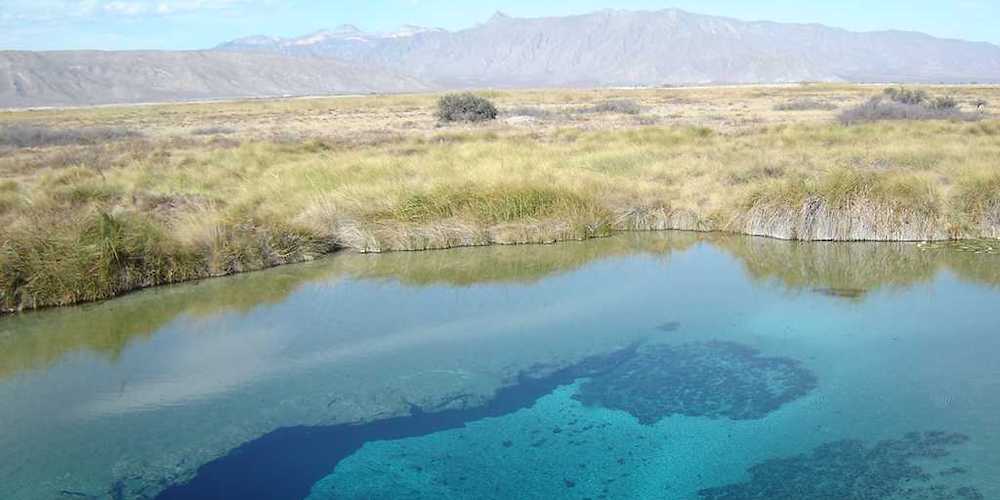
A Cuatro Ciénegas spring – ©Chanilim714 CC BY-SA 3.0 via Wikimedia Commons
Some areas, isolated in the Chihuahuan desert, such as the oasis valley of Cuatro Ciénegas is rich in wildlife including many endemic species. Eight hundred eighty-five animal species have been described and classified in the Cuatro Ciénegas valley, 38 of which are endemic (mollusks, crustaceans, scorpions, dragonflies, fish, reptiles, and amphibians). There are no birds endemic to the state but is home to half a dozen endemics and a wide range of arid area specialists.
-
Zona del silencio
InformationSatellite ViewZona del silencio is located in Durango and Coahuila in the north of Mexico and is a dessert ecosystem.
-
Wikipedia
GNU Free Documentation License
https://en.wikipedia.org/wiki/Coahuila
-
Number of bird species: 453
(As at November 2024)State Bird: Golden Eagle Aquila chrysaetos
-
Avibase
PDF ChecklistThis checklist includes all bird species found in Coahuila , based on the best information available at this time. It is based on a wide variety of sources that I collated over many years. I am pleased to offer these checklists as a service to birdwatchers. If you find any error, please do not hesitate to report them. -
eBird
PDF ChecklistThis checklist is generated with data from eBird (ebird.org), a global database of bird sightings from birders like you. If you enjoy this checklist, please consider contributing your sightings to eBird. It is 100% free to take part, and your observations will help support birders, researchers, and conservationists worldwide.
-
Amphibians and Reptiles of the State of Coahuila
| By Julio A Lemos-Espinal & Hobart M Smith | Universidad Nacional Autónoma de México | 2007 | Paperback | 550 pages, Maps, colour photos, figures | ISBN: 9789709000405 Buy this book from NHBS.com
-
*Protected areas of Coahuila
InformationSatellite ViewNational Parks, refiges, etc -
BR Cuatro Ciénegas de Carranza
InformationSatellite ViewCuatro Ciénegas is an official Mexican biological reserve. The biological reserves are small ecosystems with unique fauna and flora that are highly protected by government authorities. Scientists working in the basin and some local residents claim to have observed reduced spring discharge and a decrease in surface water in the Cuatro Ciénegas Basin (CCB) in recent years, although these changes have not been well documented in the scientific literature. Some have blamed the possible drying out on changes in climate and others have ascribed it to the introduction of large scale agriculture in adjacent valleys over the past two decades. -
BR Mapimí
InformationSatellite ViewPor sus características de aridez y vegetación contiene ecosistemas representativos del desierto chihuahuense y de la subprovincia geográfica de Mapimí… -
NP Cumbres de Monterrey
InformationSatellite ViewThe Cumbres de Monterrey is a national park of Mexico located in the northern portion of the Sierra Madre Oriental near the city of Monterrey, Nuevo León. The park includes the famous symbol of Monterrey, the signature skyline known as Cerro de la Silla (Saddle Mountain). The park consists of rugged terrain boasting steep mountains reaching an elevation of 2,260 meters (7,410 feet) above sea level, deep canyons, rivers and waterfalls. -
NR El Carmen
PDF ArticleSatellite View
-
eBird
SightingseBirding This Month
-
BirdQuest
Tour OperatorOff the beaten track for Thick-billed and Maroon-fronted Parrots, Eared Quetzals and much more -
Calidris Birding Tours
Tour OperatorMexico Rare Endemics Birding Tour
-
The Avifauna od the Sierra del Carmen of Coahuila
PDF Article1.54 Vol. 57 THE AVIFAUNA OF THE SIERRA DEL CARMEN OF COAHUILA, MEXICO By ALDEN H. MILLER In the desert of northern Coahuila, Mexico, lies a rugged mountain system collec- tively known as the Sierra de1 Carmen. The high northern part of this sierra is about 30 miles in extent along a north-northwest axis and it supports conifer and pine-oak vegetation that is well isolated from other such ecologic formations of significant area1 extent...

