Free and Sovereign State of Hidalgo

Hidalgo is one of the 31 states which, along with Mexico City, constitute the 32 federal entities of Mexico. It is divided into 84 municipalities and its capital city is Pachuca de Soto with a population of c.700,000 people. It is located in east-central Mexicoand is bordered by San Luis Potosí and Veracruz on the north, Puebla on the east, Tlaxcala and State of Mexico on the south and Querétaro on the west.
Hidalgo is known for its rugged, mountainous terrain rising to 3,300 metres in places, though part of the state is on a coastal plain. With a population of nearly three million people and an area of almost 21,000 square km (8,000 square miles), Hidalgo is one of Mexico’s smaller states. The state contains a number of ecotourism, cultural and archaeological attractions including the Huasteca area, the ruins of Tula, natural hot water springs, old haciendas and mountain ranges. The state is divided into three geographical regions: the Atlantic Coastal Plain, the Sierra Madre Oriental (mountain ranges), and the Trans-Mexican Volcanic Belt, which contains the highest peaks. Each region being distinct from the others.
The Sierra Alta region is part of the Sierra Madre Oriental mountain system, and in the temperate climate zone of the state. Some of Hidalgo’s main peaks are located here as are many of Hidalgo’s caves. The Sierra Baja is also located in the Sierra Madre Oriental system and is characterised by small plains surrounded by stony peaks. There are five major canyons located here, which take their names from the rivers that form them, from south to north: Amajac, Meztitlan, Amolon, Mezquititlán and Tolantongo.
Although lower than the temperate Sierra Alta, the Sierra Baja still has a temperate climate due to strong, moist winds which flow from the northeast. The Sierra Gorda mountain range is a branch of the Sierra Madre Oriental which crosses northwest Hidalgo and ends in San Luis Potosí. These are mostly mountains of volcanic origin. The Tula and Moctezuma Rivers meet here, whose waters then cut the Moctezuma Canyon, which has walls up to 480 meters high. The Sierra de Tenango or Sierra Norte de Puebla mountain range begins to one side of the Valley of Tulancingo and extends down to the Huasteca region of the states of Puebla and Veracruz. The range is also known as the Sierra de Huayacocotla, with low lying mountains of a humid, cloudy temperate climate with frequent rain in the summer. Two of Hidalgo’s main dams, the Tejocotal and the Omitemetl, are located on the rivers here, and are part of the Necaxa Hydroelectrical System.

Looking south from Peña del Aire, Huasca de Ocampo – ©Thelmadatter CC BY-SA 3.0 via Wikimedia Commons
La Comarca Minera is the mining district in the mountains around Pachuca and Real del Monte. Cerro de las Navajas is located here, a mountain made primarily of obsidian. The mining district and mountains extend from Pachuca north towards the municipality of Huasca, then east towards Actopan. From Pachuca it also extends a short ways south to Mineral de la Reforma and Comarca. In most of this region there is extensive mining, both of precious metals as well as lead and building stone, such as sandstone and marble. In additions to mines, the area is home to extensive forests of Oyamel fir, pines. and oaks. Many of its peaks are rocky and barren such as Zumate in Omitlán, Peñas Cargadas in Real del Monte and Peña del Conejo in San Jerónimo.
The Valley of Tulancingo has a temperate climate with an average year-round temperature of 15C. It is bordered by the Sierra de Tenango and the highlands of Apan. It is a large fertile valley with extensive agriculture. The very northern part of the Valley of Mexico is located within the state, which is separated from the area in which Mexico City is found by a series of low-lying mountains. This part of the Valley extends from Tizayuca towards Pachuca. It is separated from the Valley of Mezquital by the Sierra de Tezontlalpan and from the rest of the Valley of Mexico by the low-lying Sierra de los Pitos. The climate here is temperate and semi-arid with occasional freezes. Except for the forests on the mountain tops, the flora and fauna are those found in more arid regions such as maguey, yucca, rabbits, armadillos and mesquite trees. Since many of the mountains surrounding Pachuca lack tree cover, little slows the prevailing winds which can reach speeds of up to 120 km per hour. This gives the capital city the nickname of La Bella Airosa (Beautiful Windy City).
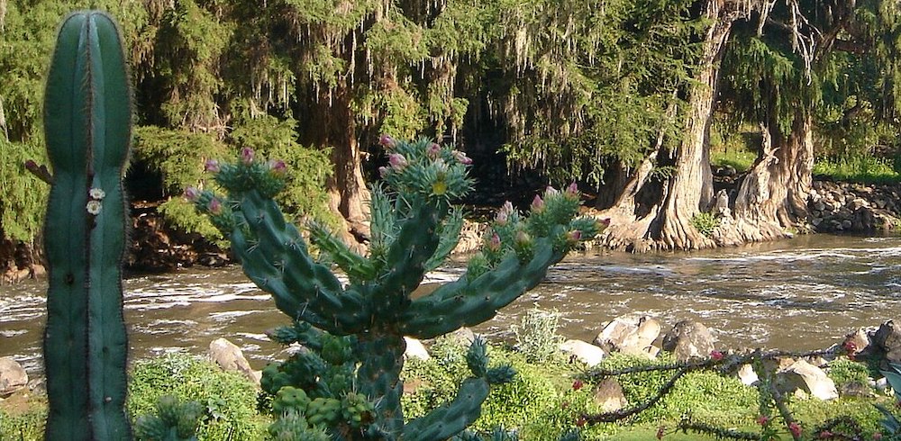
The Valley of Mezquital is three valleys called the Actopan, the Ixmiquilpan and the Tasquillo as well as flat areas known as Tula and Alfajayucan. The vegetation is mostly that of semi-arid regions with mesquite trees and various types of cacti growing. The only areas with tree cover are those near streams and other water sources and on the mountain tops of the peaks. Despite this, the region is considered to be Hidalgo’s granary, growing corn, beans, wheat, tomatoes, onions, oats, olives, cactus fruit, tejocote and much more. It produces more than half of the alfalfa and green chili peppers in Mexico. Due to the lack of rainfall, irrigation from the areas above and below ground streams is important. However, it is also one of the areas of Mexico with the highest levels of malnutrition. The valley averages 2000 meters above sea level and has a temperate climate with freezes being rare.

Headwaters of the Tula River – ©Helaxite, Public domain, via Wikimedia Commons
Principal rivers include the Tula, Amajac and the Metztitlan. Other rivers in the state flow into these three, such as the Rosas, Cuautitlan, Guadalupe and Salado, which flow into the Tula River. One exception to this is the San Juan River, which forms part of the state’s border with Querétaro. This river flows into the Pánuco River in San Luis Potosí. The Amajac begins in the Sierra de Pachuca and flows southeast. The Metztitlan River begins at the state’s border with Puebla state and eventually flows into Metztitlan Lake. Principal lakes in the state are the Metztitlán, Zupitlan or Tulancingo, San Antonio, Pueblilla and Carrillos. The state also has a significant number of sulphur and hot water springs such as La Cantera in Tula, Mixquiahual and Vito in Atotonilco, Tephé in Ejido Tephé, Humedades y Dios Padra in Ixmiquilpan and Tolantongo and Textacapa in Cardonal.
There are three main climates in the state. The lowlands are hot with temperatures rising as high as 44C in the summer in places such as the municipality of Pisaflores. Temperate regions can have hot days but often the temperature is moderated by cooler winds and clouds. Cold climates dominate the highest altitudes where freezing temperatures at night are not uncommon. Rainfall varies widely from as low as 250mm per year to as high as 2,800mm per year. The main indicator of climate type is altitude. The north of the state has the lowest elevation and the hottest climate.
Birding Hidalgo
Most plants are either of arid and desert habitats, or of the Sierra Madre Oriental pine-oak forests habitat, with Mexican pine Pinus pseudostrobus in the higher mountains.
Wildlife includes 31 species of reptiles, thirteen species of duck, six doves, and three falcons, as well as mammals such as skunks, spider monkeys, wild boar, anteaters, and grey foxes.
A small habitat in the state is the Huasteca highland rainforest. It has plants blooming nearly year-round. The area has one of the widest varieties of birds including eagles, hummingbirds, and wild turkeys. Reptiles include a wide variety of snakes, and mammals include coyotes, bobcats, wild boar, spotted deer, and rabbits.
-
Wikipedia
GNU Free Documentation License
https://en.wikipedia.org/wiki/Hidalgo_(state)
-
Number of bird species: 568
(As at November 2024)
-
Avibase
PDF ChecklistThis checklist includes all bird species found in Hidalgo , based on the best information available at this time. It is based on a wide variety of sources that I collated over many years. I am pleased to offer these checklists as a service to birdwatchers. If you find any error, please do not hesitate to report them. -
eBird
PDF ChecklistThis checklist is generated with data from eBird (ebird.org), a global database of bird sightings from birders like you. If you enjoy this checklist, please consider contributing your sightings to eBird. It is 100% free to take part, and your observations will help support birders, researchers, and conservationists worldwide.
-
*Protected areas of Hidalgo
InformationSatellite ViewNational parks etc -
BR Barranca de Metztitlán
InformationSatellite ViewBarranca de Metztitlán is a biosphere reserve in the Mexican state of Hidalgo. It is protected for its dramatic scenery of steep cliffs and deep winding canyons, and its distinctive flora and fauna. -
NP El Chico
InformationSatellite ViewParque Nacional El Chico… -
NP Los Mármoles National Park
InformationSatellite ViewLos Mármoles National Park is a protected natural area in northeastern Mexico. It is located in the western Sierra Madre Oriental of northern Hidalgo.
