Free and Sovereign State of Tlaxcala

Tlaxcala is one of the 32 federal entities that comprise the Federation of Mexico. It is divided into 60 municipalities and the capital city and the largest city is Tlaxcala de Xicohténcatl, after which the state was named. It is located in east-central Mexico, in the altiplano region, with the eastern portion dominated by the Sierra Madre Oriental. It is bordered by the states of Puebla to the north, east and south, México to the west and Hidalgo to the northwest. It is the smallest state of the republic, accounting for only 0.2% of the country’s territory, covering just over 2000 km2 (c. 1500 square miles). The political heart of the state is its capital, Tlaxcala, it’s largest city with about 640,000 people, almost half of the state’s inhabitants. Tlaxcala lies at the foot of the northwestern slope of La Malinche volcano in the Sierra Madre Oriental. It is one of the oldest cities in Mexico, founded as an organized civilization before the 15th century.
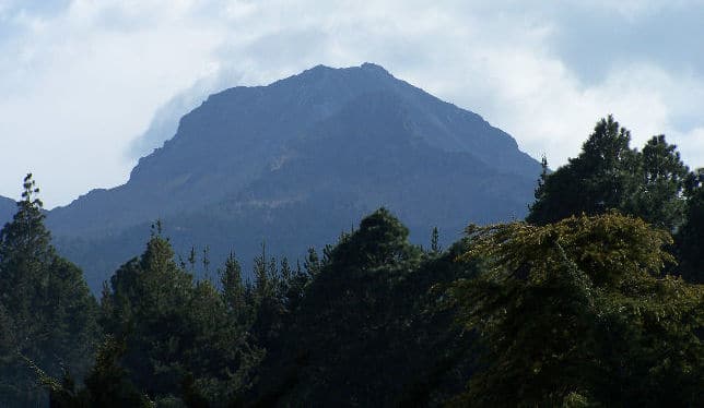
Tlaxcala is a land-locked state situated on the Trans-Mexican Volcanic Belt. The average altitude for the state is 2,230 meters asl., making it a bit higher than the Valley of Mexico just to the southwest. The western part of the state lies on the central plateau of Mexico while the east is dominated by the Sierra Madre Oriental, home of the 4,461 meter La Malinche volcano. Most of the state is rugged terrain dominated by ridges and deep valleys, along with protruding igneous rock formations. This ruggedness, along with large-scale weather phenomena such as the Intertropical Convergence Zone, gives the state a complex climate. Overall rain patterns for the state are about 16 inches in the summer rainy season and 1.2 inches in the winter. Locally, however, this varies dramatically between the drier plateaus and valleys and the wetter mountains. Variations in altitude produce sub-climates between semi-tropical and temperate, with frosts likely in the higher elevations during the winter. Temperate fir, juniper and pine-oak forests dominate the mountain highlands, while the flatlands, with their drier climate, are characterised by agaves and prickly pear cactus.

Volcan La Malinche – Public domain, via Wikimedia Commons
The state has no major lakes or large rivers. The principal water sources are the Atoyac-Zahuapan basin and the reservoir of the Atlangatepec dam. Much of Tlaxcala’s economy is based on agriculture, livestock and forestry. Principle crops for the state are maize and barley, along with important quantities of wheat, beans, animal feed and potatoes, using about 60% of the state’s land. Although the state has 15 dams and 483 wells to provide water for agriculture, 88% of the state’s agriculture is dependent on the summer rainy season, leaving it vulnerable to climatic phenomena such as El Niño or La Niña.
Birding Tlaxcala
For a small and populous state the list of birds seen at around 435 species is surprisingly high, and this list includes a couple of dozen Mexican endemics. Migrants swell the numbers and number of species of course, but there are still great birds to be seen, especially in the sierras. Farmland mostly, but not exclusively, attracts the commoner species found in southern North America.
The only notable wildlife protection area is La Malinche National Park which is shared with the neighbouring state of Puebla, altogether covering over 46,000 hectares. The park hosts an impressive diversity of flora, including endemic species such as Pino Hartwegii and Abies religiosa, which thrive at the mountain’s heights, providing a unique ecosystem for wildlife. From foxes and opossums to migratory birds that make the park their temporary home, La Malinche is a true refuge for biodiversity. While La Malinche is accessible year-round, the Autumn and Spring seasons offer ideal weather conditions for most activities and the peak of bird movements. Most of the park’s area is covered by coniferous (pine) forests that provide habitat to more than 100 mammal species, more than 150 bird species, and a number of amphibians and reptiles.

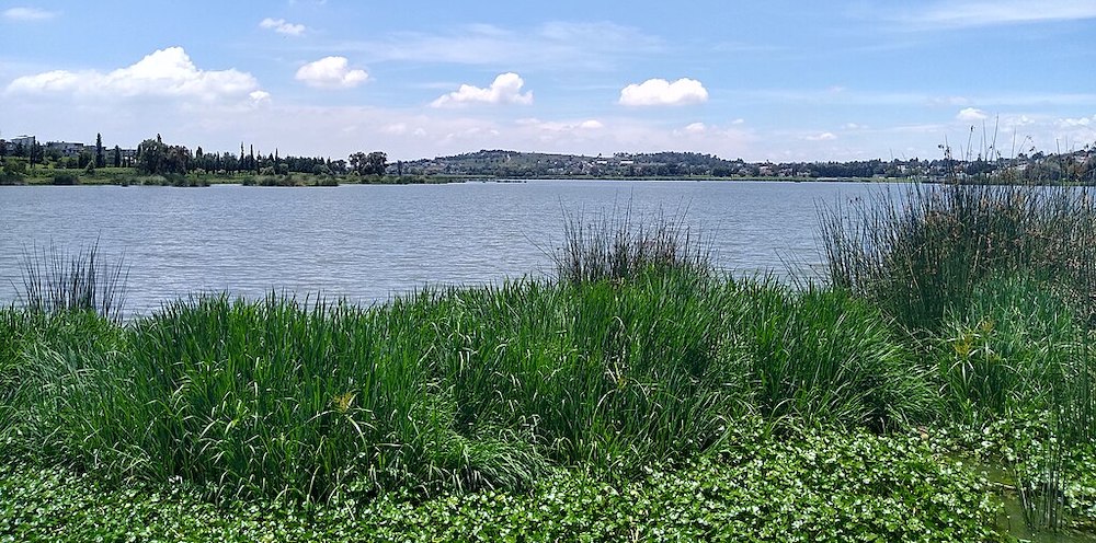
Laguna de Acuitlapilco – ©Isaacvp CC BY-SA 4.0 via Wikimedia Commons
Laguna de Acuitlapilco is good for ducks, herons and other water birds, but also for passerines around the margins, from Red-winged Blackbirds and Canyon Towhee to Black Phoebe and Lucifer Hummingbird. Migrants are attracted to the changing water levels.
-
Number of bird species: 435
(As at November 2024)
-
Avibase
PDF ChecklistThis checklist includes all bird species found in Tlaxcala , based on the best information available at this time. It is based on a wide variety of sources that I collated over many years. I am pleased to offer these checklists as a service to birdwatchers. If you find any error, please do not hesitate to report them. -
eBird
PDF ChecklistThis checklist is generated with data from eBird (ebird.org), a global database of bird sightings from birders like you. If you enjoy this checklist, please consider contributing your sightings to eBird. It is 100% free to take part, and your observations will help support birders, researchers, and conservationists worldwide.
-
La Malinche Scientific Station
WebpageLa Malinche is a protected natural area that holds the only scientific station in the high mountain forests of Mexico. Two researchers based in the park where they carry out intense research work —Margarita Martínez, from UNAM, and Arturo Estrada-Torres, from the Autonomous University of Tlaxcala (UATx, Spanish initials)—tell us about the project’s history and future.
-
NP La Malinche
InformationSatellite ViewLa Malinche National Park is located in the states of Puebla and Tlaxcala in Central Mexico. The park is east of Mexico City, and about 44 kilometres (27 mi) from the capital city of Tlaxcala, Tlaxcala.
